
Sources for Past Lee's Summit Residents
A backward address trail changes source as it crosses record eras. Begin with the current parcel and recorded deed, then move to microfilm, directories, newspapers, maps, census schedules, and archive catalogs when the online index ends. None of these sources alone establishes every person who lived at an address. Together, they can separate a property transfer from a household clue and make the date of each claim clear.
| Source | Years it covers | Where held | What it shows |
|---|---|---|---|
| Recorder ordinary-document index | Roughly early 1960s forward online | Jackson County Aumentum | Grantor, grantee, instrument reference, and image where digitized |
| Recorded plats | Back to 1826 | Recorder and Aumentum | Subdivision and lot context for a legal description |
| Recorder microfilm and deed books | Earlier, non-digitized documents | Jackson County recording offices | Older recorded instruments and the bridge before online images |
| MGC city-directory collection | Exact Lee's Summit years unverified | Midwest Genealogy Center | Possible historic address and family clues after shelf verification |
| Federal census | 1790-1950 public | NARA partners and MGC | Dated household snapshot, enumeration district, and sheet |
| Lee's Summit Sanborn map | September 1898 | Library of Congress | Building footprint, street names, and adjacent use, not occupants |
For a recent transfer, use the parcel and Recorder first. For an old address, identify the legal description and city-name variant, then test whether a deed book, map, directory, or census source actually reaches the period. The city lies primarily in Jackson County but extends into Cass County, so confirm the county from the parcel or instrument before assuming the Jackson County route applies.
Note: An owner on a deed or property card is a property connection, not proof that every person at the address lived there.
Start with a Lee's Summit Parcel
The Jackson County Assessment public property portal is the current-address starting point. The county advertises searches by owner name, account or PIN, property address, and mailing address. Record the physical situs address, parcel number, and legal description. A situs address is the physical location assessed by the county, while a mailing address is where correspondence goes. They can differ without identifying the people at the property.
Next, open the Jackson County Parcel Viewer to confirm the parcel number, legal description, lot size, district information, and map relationship. Its dimensions are approximate and are not survey evidence. The viewer directs recorded-document questions to Aumentum, which is the proper bridge from a mapped parcel to the deed trail.
Lee's Summit Previous Residents Deed Chain
A deed chain traces recorded interests backward, not a complete household roll. Start with the current owner listed by Assessment or GIS, then use Aumentum's Real Estate Index to locate that owner's acquisition instrument. The seller on that deed becomes the next name to search. Compare the parcel number, subdivision, lot, block, and legal description on each instrument, because an old street address can be absent or inconsistent.
- Save the parcel number, legal description, and current owner from the county property record.
- Search the current owner as a grantee to locate the deed by which that interest was received.
- Open the instrument and record its date, document or book-and-page reference, parties, and legal description.
- Search the seller as a grantee to find the prior acquisition, then repeat the comparison backward.
- When the online image sequence ends, ask the Recorder about microfilm or deed-book access and use the State Archives and MGC as additional historical routes.
- Grantor
- The party who transfers or conveys an interest in a recorded instrument.
- Grantee
- The party who receives that recorded interest. A former grantor may be the next grantee to search farther back.
- Chain of title
- The succession of recorded instruments used to follow an interest from one party to another. It is not the same as a list of residents.
- Legal description
- The lot, block, subdivision, or other land description used in deeds. It is often the steadier bridge when a street number changes.
Lee's Summit Grantor List Search
The Jackson County Grantor List supports the seller-to-earlier-owner step in a backward title search. Use spelling variants where the index permits them, then test each result against the legal description and recorded date. The recorder also exposes a grantee list, subdivision list, marriage records, and the broader official-public-records index, so the grantor screen is one part of the evidence trail.
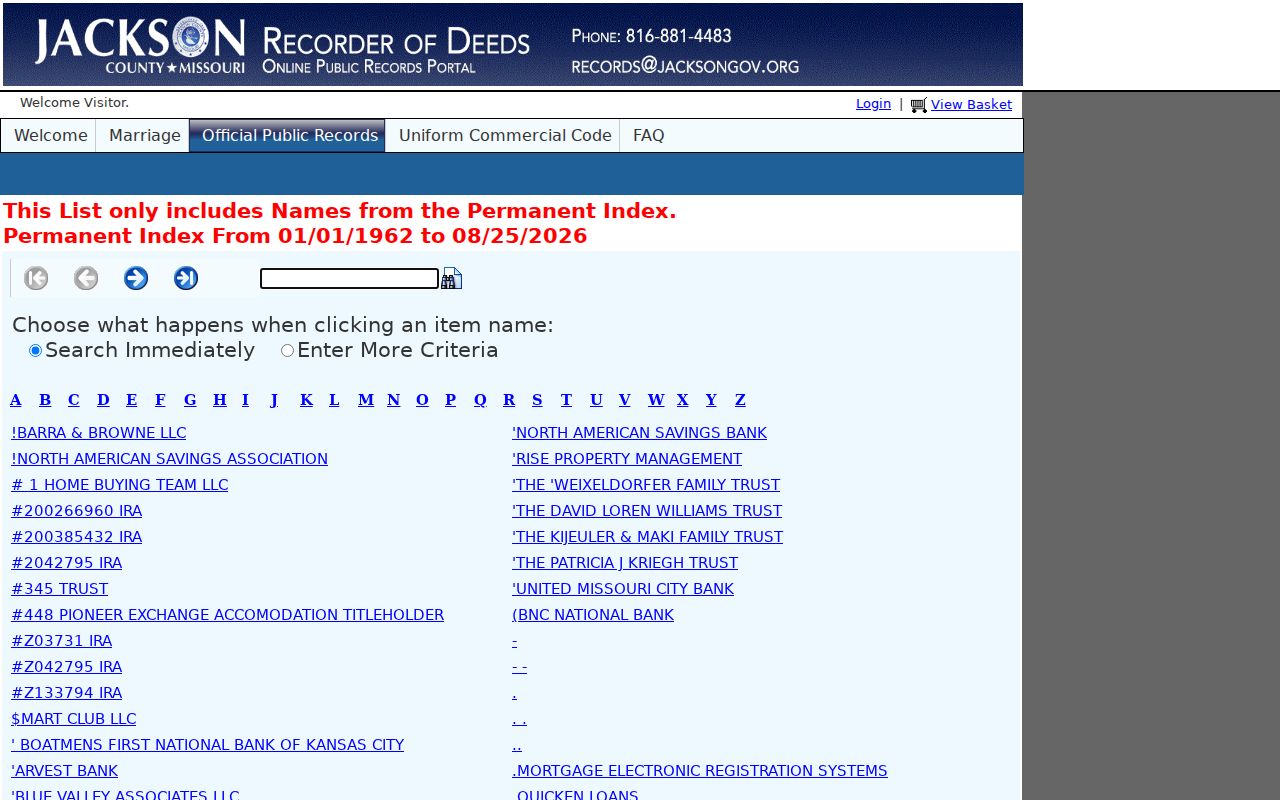
The search screen illustrates why a name is only a starting point. A matching result still needs the instrument reference and parcel details before it can be connected to a Lee's Summit address. Free online viewing and printing apply to the digitized material; confirm copy charges before requesting a plain or certified copy.
Lee's Summit Past Residents Before Online Images
Jackson County describes roughly ten million recorded documents dating to the county's 1826 creation, with more than 90 percent land-related. Ordinary recorded-document images and indexes are available online from roughly the early 1960s forward, while historic plats can reach back to 1826. Earlier documents that are not digitized are available on microfilm at the recording offices. That online cutoff is the key comparison point for any previous residents search that reaches into the mid-twentieth century or earlier.
The Recorder's search guide identifies the online and microfilm routes. The Missouri State Archives county-records database adds a catalog search by county, office type, record type, keyword, city, and year range. It is browseable, not a universal name index, so choose the office and period before assuming a search will return a person.
Note: Plats and deed references can carry a trail farther back than web images, but they do not replace checking the original record.
Lee's Summit Past Residents in Directories
Directories can add the household layer that deeds do not supply, but the exact Lee's Summit run has not been confirmed in the reviewed official material. MGC states that it holds city directories, newspapers, yearbooks, maps, and census resources. A reverse or criss-cross section may arrange a volume by street and address, then point to a name entry. Do not assume a specific MGC volume has that section until the volume is in hand and its arrangement is checked.
Use a verified city-directory entry with a census schedule rather than treating either one as complete. The directory collection process, its digital limits, and the shelf-check questions are covered on the Lee's Summit City Directories page. The record trail here stays focused on moving one address backward through time.
A useful household sequence is: verified directory year, closest census year, deed or legal description, then newspaper or obituary evidence. Each source should retain its own date and citation.
Lee's Summit 1898 Address Map
The Library of Congress Sanborn map is a concrete local checkpoint: two Lee's Summit sheets dated September 1898. It can show building footprints, street names, and nearby uses at that date. Pair it with a deed, directory, newspaper item, or census schedule to separate a building question from a question about who lived there.
The city's history also records the 1885 downtown fire, reported in the Lee's Summit Journal. A later building or map feature may fit a rebuilding timeline, but neither the fire nor the map proves a particular person occupied the address. Use each as dated context, not a name record.
Lee's Summit Previous Residents Name Traps
Older searches can fail because the town had more than one name. The city was platted as the Town of Strother in 1865; the post-office name changed in February 1868, and incorporation and renaming followed later that year. Try Lee's Summit, Lees Summit, and Town of Strother when a catalog or index allows text searching. Preserve the spelling and punctuation that each record uses instead of silently normalizing it.
Address continuity has limits too. No official source reviewed supplied a verified citywide street-renumbering year, complete renaming index, or full annexation-by-address bridge. When a number seems to change, use the parcel, legal description, plat, map, and county as the bridge. Mark an address match as an inference until those records support it.
Lee's Summit Past Residents Trail Endpoints
A prior-resident trail may end in a probate file, obituary, cemetery record, or a changed address rather than another deed. The 16th Judicial Circuit probate route can identify an estate case where public access is not sealed, and the clerk controls file copies. For a deceased person, the city's Historical Cemetery and Howard Cemetery resource describes an interactive map and interment directory. A burial or estate record can close a historic trail, but it is not proof of a full lifetime address history.
MGC's Jackson County Collection, MGC1015, is open for research and includes local material such as a 1938 Lee's Summit High School graduation program within a wider 1894-2001 collection. Newspapers, yearbooks, and cemetery records can add family-history context when the deed chain alone reaches a dead end.
Past Households at Lee's Summit Addresses
Owners and past residents are different evidence trails. Use recorded deeds to follow an interest in the parcel, then add a verified directory, census page, newspaper item, or cemetery record to test household history. The last fully public federal decennial census is 1950 under the 72-year release rule. MGC's named microfilm coverage reaches 1930, while later digitized census access may be available there through licensed or partner services.
For a lawful family-history or house-history project, keep the evidence in date order: address and parcel, current deed, prior deed, older microfilm record, verified directory or newspaper item, census sheet, and any probate or cemetery endpoint. That order makes uncertainty visible and avoids turning a property record into a claim about everyone who lived at the address.
Lee's Summit Previous Residents Limits
Public records have boundaries. A deed shows a recorded instrument and legal interest; it does not establish every adult household member, utility user, delivery recipient, or other person connected to an address. Protected voter addresses, Safe at Home participants, sealed court files, and restricted vital records are not ordinary lookup results. Missouri's Sunshine Law can provide a route to existing public records from the right custodian, but a request should be specific about the record type and date range.
Lawful use. Lee's Summit previous-resident research is appropriate for family history, estate questions, and property history. Missouri law prohibits stalking and harassment; do not use historical information to track, threaten, or harm a living person.