
Find Lee's Summit Street Records
Address work in Lee's Summit starts in Jackson County, although a small part of the city lies in Cass County. Confirm the county shown by the parcel before choosing a custodian. The county assessment record connects a physical address to an account and owner information. The parcel map then supplies the legal description that keeps the search stable when street wording changes. Ownership is not the same thing as proof that every person in a household lives there.
Use the following street-directory sequence for a named street or a single address:
- Search the Jackson County real-property portal by property address, owner, or account/PIN. Save the situs address, parcel number, owner block, and legal description.
- Open the same parcel in the Parcel Viewer. Check street frontage and click nearby parcels one at a time rather than treating a mailing list as a block list.
- Take the owner and legal description to the Recorder's Aumentum index. Search an acquisition as a grantee, then search the seller as a grantor to move backward.
- Use CityView by permit number or address when dated construction, inspection, or planning evidence matters. It documents a project, not a resident list.
- For one known registrant, use Missouri's exact-input voter lookup. A precinct-register request belongs with the Jackson County Election Board and has release limits.
Note: Keep the parcel number with every result, because it is a more reliable bridge than a street name when address text is inconsistent.
Lee's Summit Property Search Fields
The county's public-property route separates real property from personal property. For a Lee's Summit street directory search, choose the real-property path. The available descriptions confirm address, owner-name, account/PIN, and mailing-address approaches, but they do not establish every live form option or match rule. The portal says assessment data can change and is not certified legal documentation. The newer county portal also offers printable record cards and shows 2022 and 2025 values under its Values tab.
| Jackson County control | Form | Required | Street-search use |
|---|---|---|---|
| Real Property | Tab or choice | No | Select the real-estate account set. |
| Property Address | Text | Optional | Searches the situs, or physical, address. |
| Owner Name | Text | Optional | Helps connect an address to an assessment owner. |
| Account/PIN | Text | Optional | Stable county identifier for the parcel trail. |
| Mailing Address | Text | Optional | County sources distinguish it from the situs address. |
The live form was showing maintenance or disclaimer material during the documented inspection. Treat this as the confirmed field set, not a promise of complete dropdowns, sorting, export, or pagination controls.
Walk Lee's Summit Parcels by Street
The Jackson County Parcel Viewer is the map half of a street-directory search. Select a parcel to see its parcel number, address, lot size, building information, land-use code, tax code area, exemption, district information, legal description, and owner panes where populated. It can also print property information or export the information pane to PDF. For a corner property, inspect both frontages and the parcels across each street.
Jackson County's Parcel Viewer shows the map and property-information pane used for a Lee's Summit street directory check.
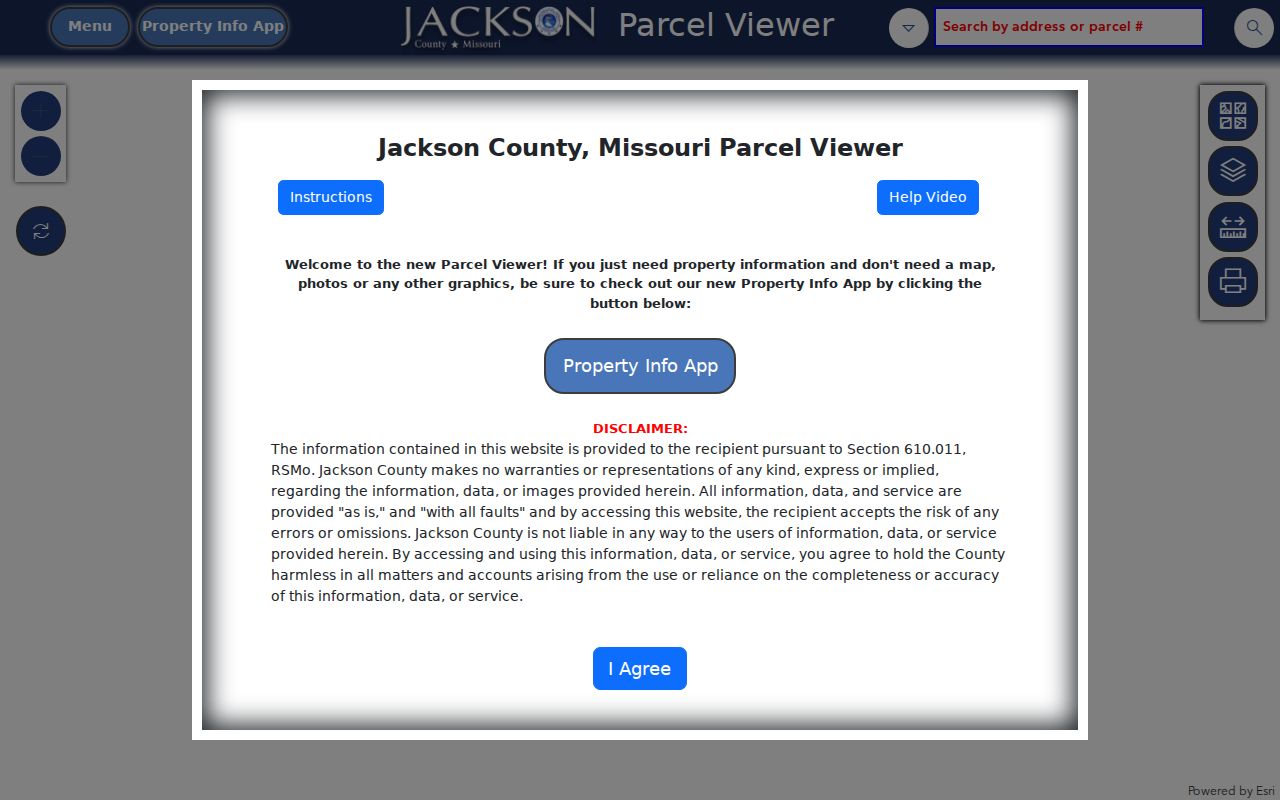
The map helps identify the parcel that actually touches or faces the address under review. Its dimensions are approximate, not survey-accurate, and easement questions belong in recorded documents.
Lee's Summit Address Terms
Three address clues often appear together but mean different things. Keeping them separate prevents a false match when a tax notice goes somewhere other than the house, or when a deed uses lot and block instead of a street number. The county's Assessment FAQ makes the same situs-versus-mailing distinction, while the Recorder uses legal land descriptions in its instruments.
- Parcel
- A county-defined property unit identified by a parcel number or account/PIN.
- Situs address
- The physical location of the property used by the county for assessment purposes.
- Mailing address
- The place where the owner asks to receive county correspondence; it may be elsewhere.
- Legal description
- The subdivision, lot, block, or metes-and-bounds wording that identifies land in a recorded document.
- Plat
- A recorded map that lays out a subdivision, lots, blocks, streets, or easements.
When an address says “Situs Verification in Progress” or no address has been assigned, follow the county's correction route rather than assuming a new city address has already reached the assessment record.
Trace Lee's Summit Deed Records
The Jackson County Recorder's online guide describes Aumentum as the central recorded-document route. Its Official Public Records area includes a Real Estate Index, Grantor List, Grantee List, and Subdivision List. Search the current owner as a grantee for an acquisition, then use the prior seller as a grantor. If street text does not work, try the subdivision, lot, and block taken from the parcel record.
The Recorder's document-search guide shows the route into the online recorded-document index.
Online images and indexes cover roughly the early 1960s forward, with selected older material and plats reaching farther back. Documents before 1962 are available on microfilm at the recording offices. The Recorder lists free online viewing and printing for digitized records, while copy and certification charges apply when an ordered copy is needed.
Aumentum's Real Estate Index is the searchable instrument screen for the recorded side of a Lee's Summit street directory search.
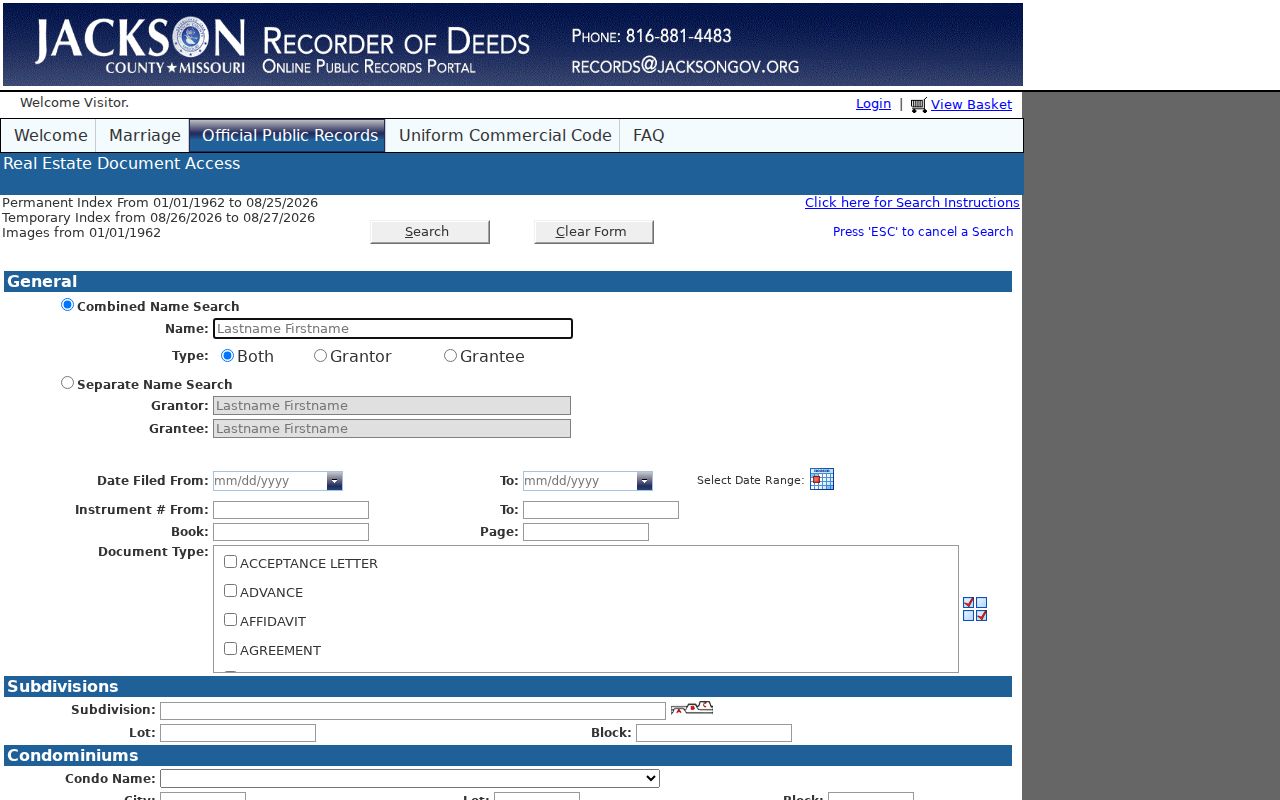
A recorded deed documents an instrument and a legal interest. It does not establish that every household member occupied the property on the recording date.
Lee's Summit CityView Evidence
CityView supplies an address-keyed municipal layer inside Lee's Summit. The city directs users to “Building Department Status and Fees” and permits an address or permit-number search. A result can include general project information, inspection reports, plan-review documents, permit type, status, date, and related planning material. It can help date visible work or a development application without turning an owner or applicant name into a household claim.
The city's June 2026 notice says CityView changed URLs and interface elements after an upgrade. If an older permit link fails, start at the city landing page and search again rather than assuming the record vanished.
Note: CityView's full live filter list was not verified in the documented inspection, so only its confirmed address and permit routes are described here.
Lee's Summit Street Records Compared
A street directory works best when each record answers one limited question. The following address-keyed sources can be compared without treating any single one as a full household roll.
| Address record | Custodian | Useful detail | Access route |
|---|---|---|---|
| Assessment account | Jackson County Assessment | Owner, situs, mailing address, values, exemptions | Public portal by address, owner, or PIN |
| Parcel map | Jackson County GIS | Parcel geometry, legal description, districts, map context | Public viewer with print and PDF export |
| Tax account | Jackson County Collector | PIN, primary owner, property or mailing address | Public tax search |
| Recorded instrument | Jackson County Recorder | Grantor, grantee, type, date, reference, digitized image | Aumentum; older items on microfilm |
| Permit or project | Lee's Summit Development Services | Permit and planning status, dates, documents | CityView by address or permit number |
For a past address listing or a criss-cross directory, use the historical collections route in the Lee's Summit city directories. That collection can add a dated household clue but should not replace current parcel and deed records.
Lee's Summit Street Geography
A Lee's Summit mailing address does not settle county custody. The city is principally in Jackson County, with a small portion in Cass County, and postal delivery geography does not follow city limits exactly. Before a street-directory search moves to the Recorder, assessment office, court, or election authority, use the parcel and address to confirm which county holds that record. Independence, not Lee's Summit, is the Jackson County seat.
ZIP codes are delivery tools, not street boundaries. An address near the city edge can need a county check even when its postal city says Lee's Summit. Street-level work after the ZIP is confirmed belongs with the parcel and deed chain, not with a ZIP-only assumption.
Lee's Summit Voter Address Route
Missouri's voter lookup has a deliberately narrow role in a Lee's Summit street directory search. It needs the exact registered first name and last name, date of birth, last four Social Security digits, and county. A street type should be omitted when the form asks for a street name. The tool checks one known registration. It does not create an open search for everyone on a street, and a non-match can result from a spelling, county, date, or last-four difference.
For Jackson County outside Kansas City corporate limits, including the Lee's Summit route, the Jackson County Election Board accepts a public-record request. Missouri law permits defined voter fields and allows precinct registers to be arranged by street address at the election authority's discretion. Protected addresses may be closed, and statutory voter lists carry a commercial-use restriction. Describe the precinct or address range, record type, date range, and lawful research purpose rather than asking for a broad household list.
Lee's Summit Older Street Evidence
An online hit is not the end of an address trail. The Recorder says ordinary recorded documents are searchable online from roughly the early 1960s, while plats and selected historic material reach further back. For non-digitized documents before 1962, the fallback is microfilm at a recording office. The Missouri State Archives' Jackson County reel guide and the Midwest Genealogy Center's Jackson County deed collection offer additional historic routes when a modern screen stops.
Use the legal description, subdivision, lot, and block from the parcel record to bridge an older deed to a newer address. That is safer than guessing from a similar street name. The Recorder describes materials dating to county formation-era records, but the online cutoff is not proof that every older item or neighborhood series is digitized.
Note: A criss-cross directory can provide a dated address clue, while an instrument, plat, or microfilm record supplies the legal property trail.
Lee's Summit Situs Corrections
County address data may lag a new or corrected physical address because the situs-change process is verified with city or county public-works staff and may take effect after the following tax year. The county form asks for the owner, property number, old and new physical address, and contact information. It directs requests to Assessment and provides GIS contact information for location-address problems.
For a street-directory match, record the displayed status before deciding two addresses are the same parcel. “No Address Provided by Taxpayer” and “No Address Assigned by City” are meaningful county status strings, not invitations to fill a gap from a map or a mailing address.
Limits of Lee's Summit Street Searches
The common mistake is treating an assessment owner, a voter match, or a commercial data-broker result as a household census. It is not. Assessment records identify a property or tax-account owner and may show a mailing address. The Missouri voter lookup is a self-check tool that requires exact name, date of birth, last four Social Security digits, and county. It is not a public street-by-street resident roster.
Missouri law permits some voter fields and allows precinct registers to be inspected under custodian rules, but protected addresses may be closed. Utility customer accounts, motor-vehicle address data, and private association rosters are not interchangeable public street records. Ask the Jackson County Election Board for a properly scoped public-record inspection when a lawful purpose calls for one.